You may find this blog post also on oceanblogs. Follow Meteor’s position in real time!
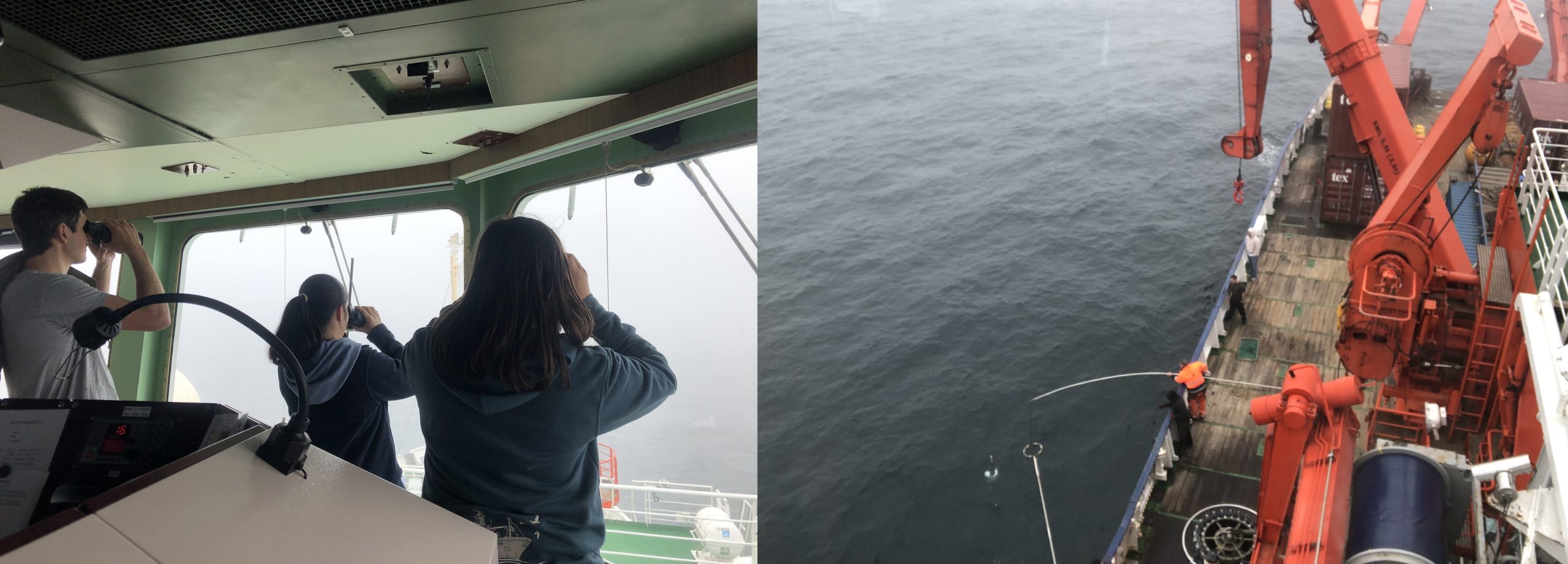
Left: Félix, Elizabeth, and Pia looking for the Argo float with binoculars. Right: The crew recovering the float.
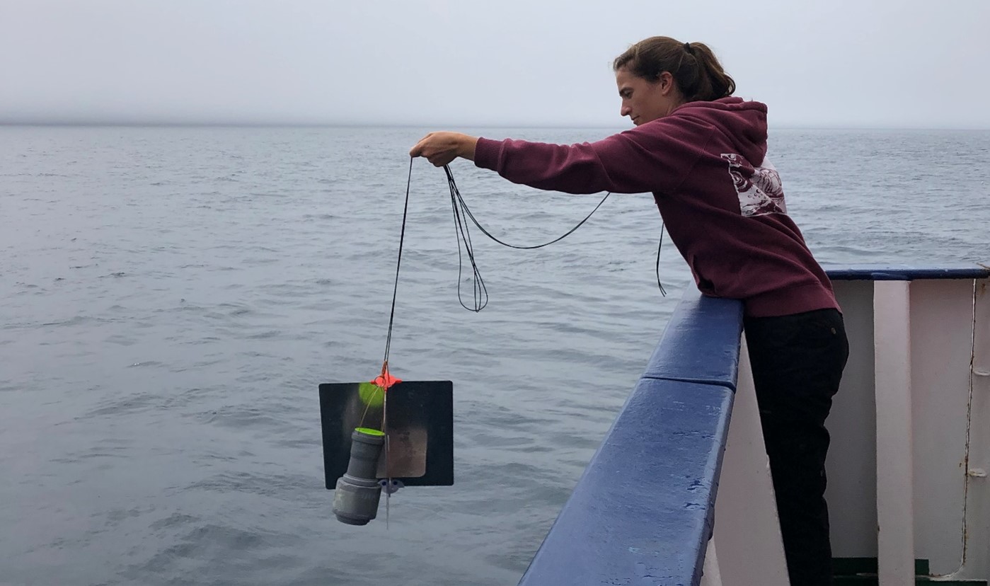
Over the past 20 years, Argo floats have caused a small revolution in the field of observational oceanography as they provide near real-time measurements of the ocean subsurface, which have greatly improved our weather forecast and ocean analysis. Currently, there are ~4,000 floats sampling the oceans year-round.
These floats are autonomous underwater profilers, which means that they are programmed to take measurements as they go down and up the water column by themselves and transmit their data to satellites when they reach the surface. Usually, the Argo floats are not recovered once deployed in the ocean. However, we did recover one of these floats today at the request of the Federal Maritime and Hydrographic Agency (BSH) because it is a quite expensive float model, and its carbon dioxide (CO2) sensor was defective. (Look up the different models of floats – The more sensors they have and deeper they can get, the more expensive a float is.)
To recover the Argo float, we first had to locate it in the ocean, which is not so easy to do even having its exact coordinates; The float was only a tiny greyish dot hardly visible between two waves and in the fog. After we had visual contact with the float, the crew further approached the vessel from the float and recovered it.
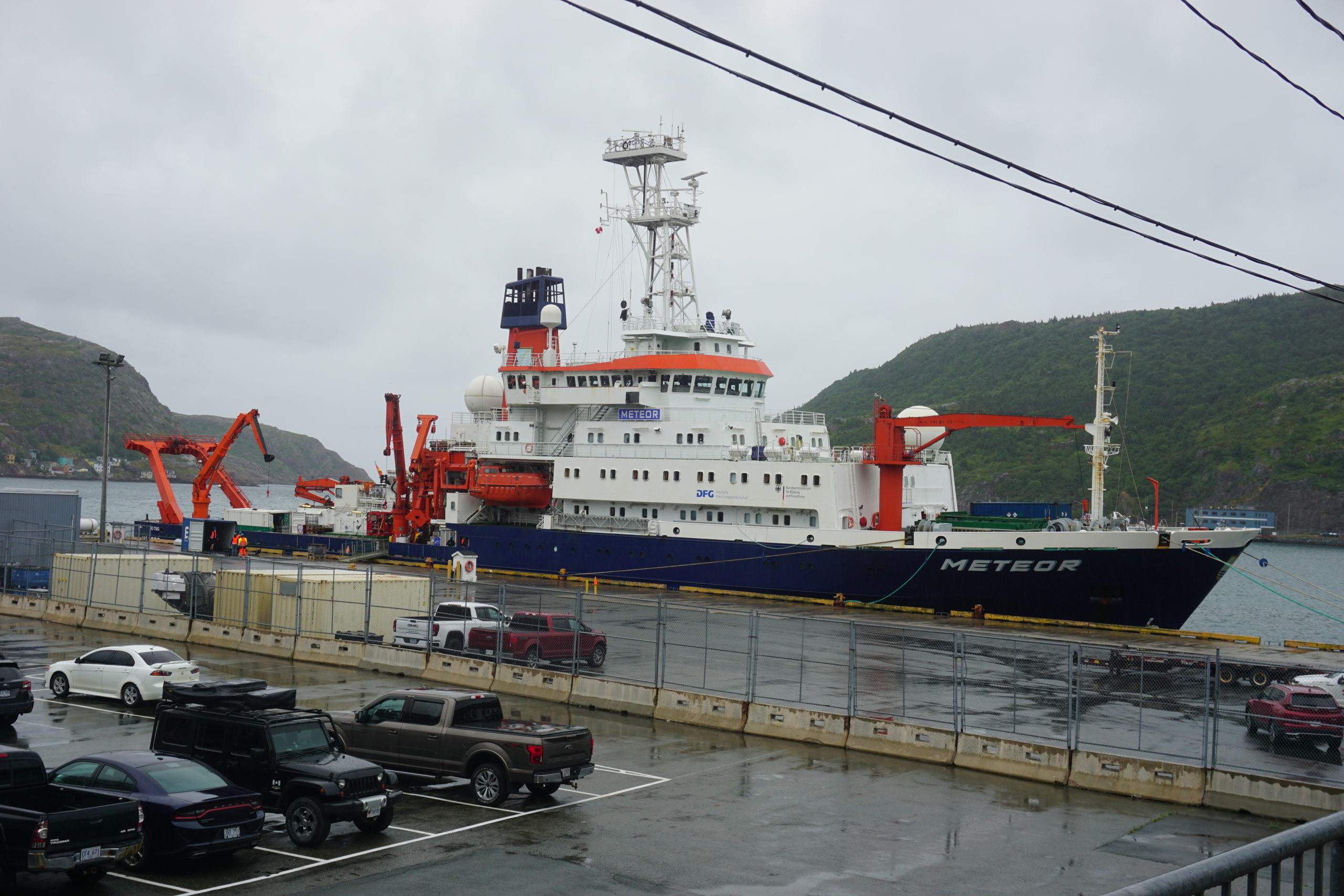
Cargos are being loaded on the Meteor in St John’s harbour. Photo by Johannes Karstensen.
Departure from St John’s Harbour
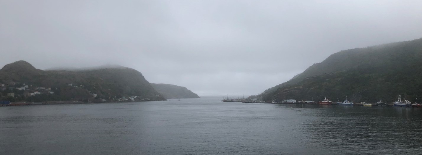
St John’s harbour in the mist.
August 11-12, 2022
The water is still in the harbour by night. Shrouded in what seems like a perpetual mist, the Meteor is waiting patiently. People step aboard the ship in small waves and wash up in their beds, exhausted from their long flights. As the sun rise, the crew finalizes the preparation for the departure. A few hours later, we are all on the deck to say goodbye to St John’s. As the ship leaves the harbour, we have a stunning view of St John’s rocky coast. As the land fades away, the swell appears and activities on board begin!
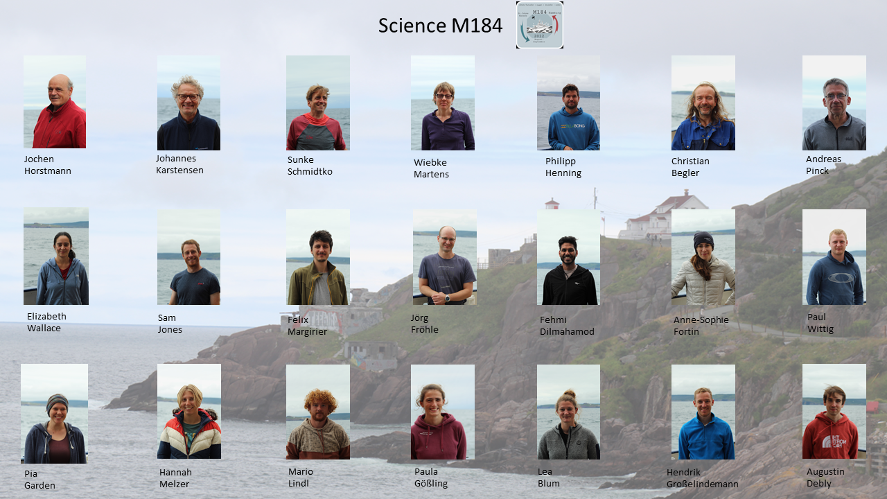
The scientific crew aboard the cruise M184. Photos and poster by Lea Blum.
First, let me introduce to you the scientific crew aboard the M184 Cruise. The chief scientist of this expedition is Johannes who takes care of the general smooth running of scientific activities on board. He can rely on Sunke (also a co-chief scientist), Félix, and Fehmi, the CTD watch leaders, and on the technicians Wiebke, Philipp, Christian, Andreas, and Paul, which are a great help in all kind of situations.
Paula, Augustin, Hendrik, Mario, Pia, Sam, Jörg, Anne-Sophie, and Hannah are split into three groups that are under the supervision of the CTD watch leaders. These teams are doing rotating shifts so that real-time data is taken around the clock, even at night.
Some people on board take the lead responsibility of specific experiments, such as the analysis of nutrients and oxygen in the water performed by Elizabeth and Lea. Sam oversees the deployment of a highly sensitive bottom pressure instrument from the Scottish Association of Marine Science (SAMS) that has a 10-year lasting battery. This instrument is one of a set of two designed to measure the sea surface height across the North Atlantic. Jochen and Paula handle the deployment of Hereon drifters, which follow surface currents. Paul manages the MicroCATs, i.e., the instruments measuring the temperature and conductivity, on the moorings deployed as part of the OSNAP program.
Throwing Scientific Instruments Overboard
Paula Gößling is lowering a Hereon Drifter with a rope at the back of the ship.
August 13, 2022
Today we (purposely) throw some scientific instruments overboard, the firsts of many. In the picture, you may see Paula lowering a Hereon Drifter with a rope. A Hereon Drifter is a Lagrangian surface drifter, which means that it follows the water mass where it has been deployed, under the condition that the water mass in question stays in the upper part of the ocean as the Hereon Drifter float at the surface. It is quite useful to estimate upper water currents as the instrument report its position every 5 minutes.
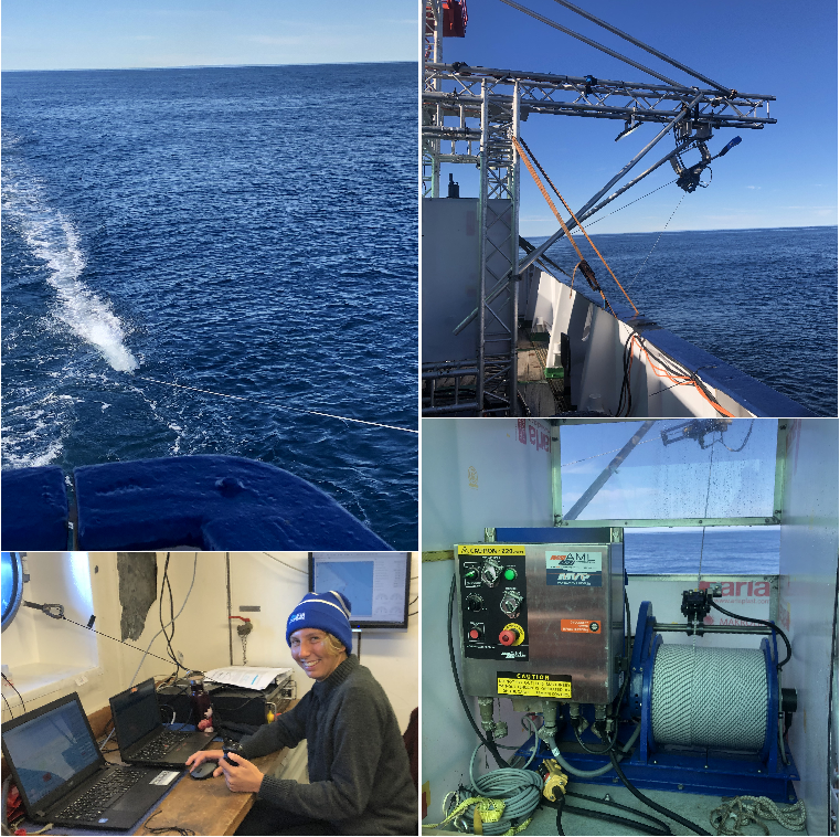
Upper Ocean Survey with the Moving Vessel Profiler
The Moving Vessel Profiler (MVP) is attached to a rope and is pulled back to the ocean surface after its free-fall. A metallic structure holds the rope of the MVP and is automatically pulled up after its free-fall on a spool. Thus, we can sit back and look at the MVP outputs on a monitor (here Hannah is on duty).
August 14, 2022
As we transit toward the next station with a speed of about 10 knots, we are taking continuous profiles of the upper 100 meters of the ocean. To do so we use a Moving Vessel Profiler (MVP), an instrument measuring temperature and conductivity (from which salinity can be derived) is free-falling in the ocean and then automatically pulled back to the surface.
The goal here is to survey the Labrador Current fronts, which are sharp changes in the temperature and salinity vertical structure over short distances, and the mixing of Labrador Current water with other water masses over the Labrador continental shelf. The Labrador Current is a water mass particularly cold, fresh, and high in dissolved oxygen.
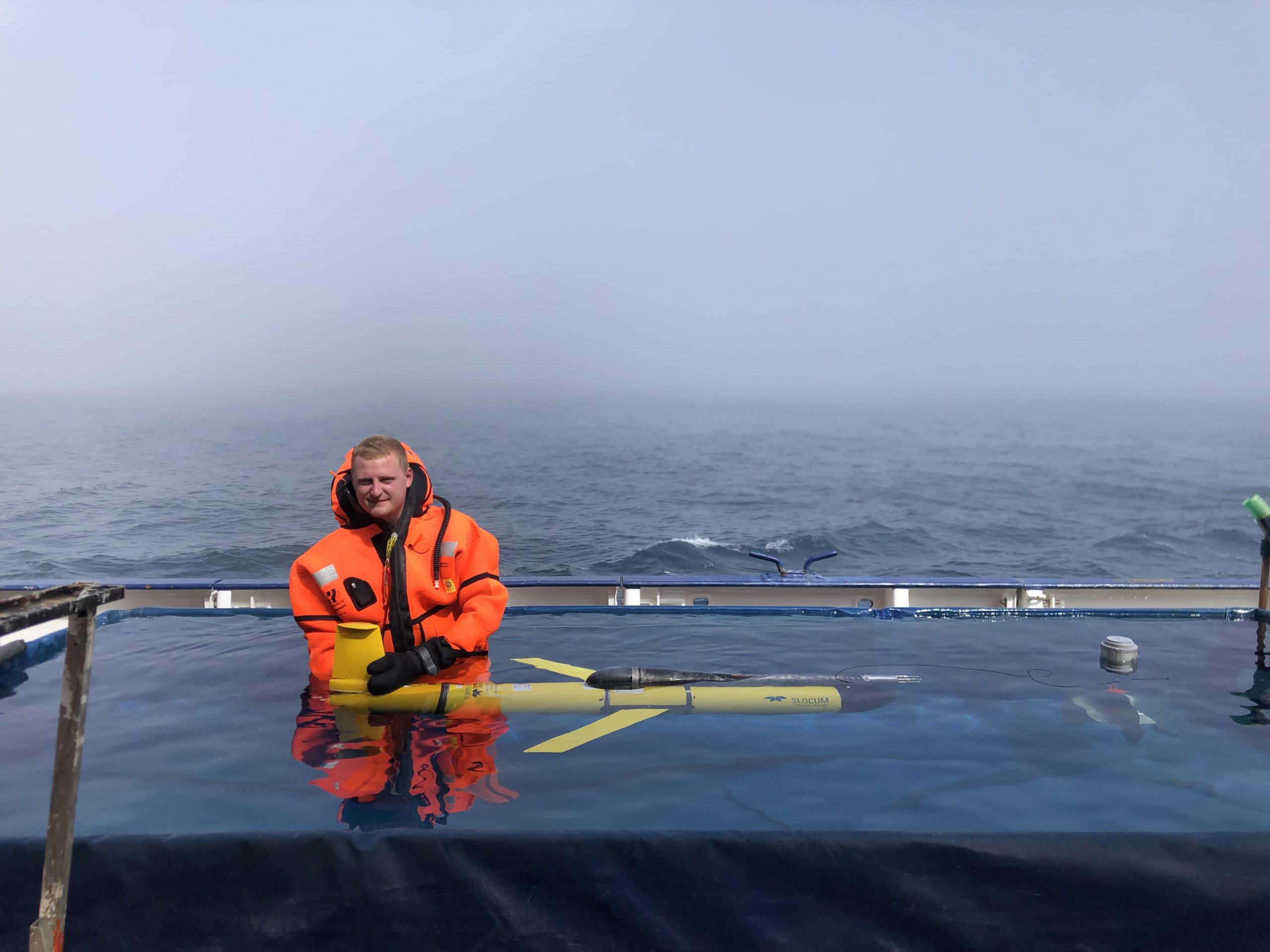
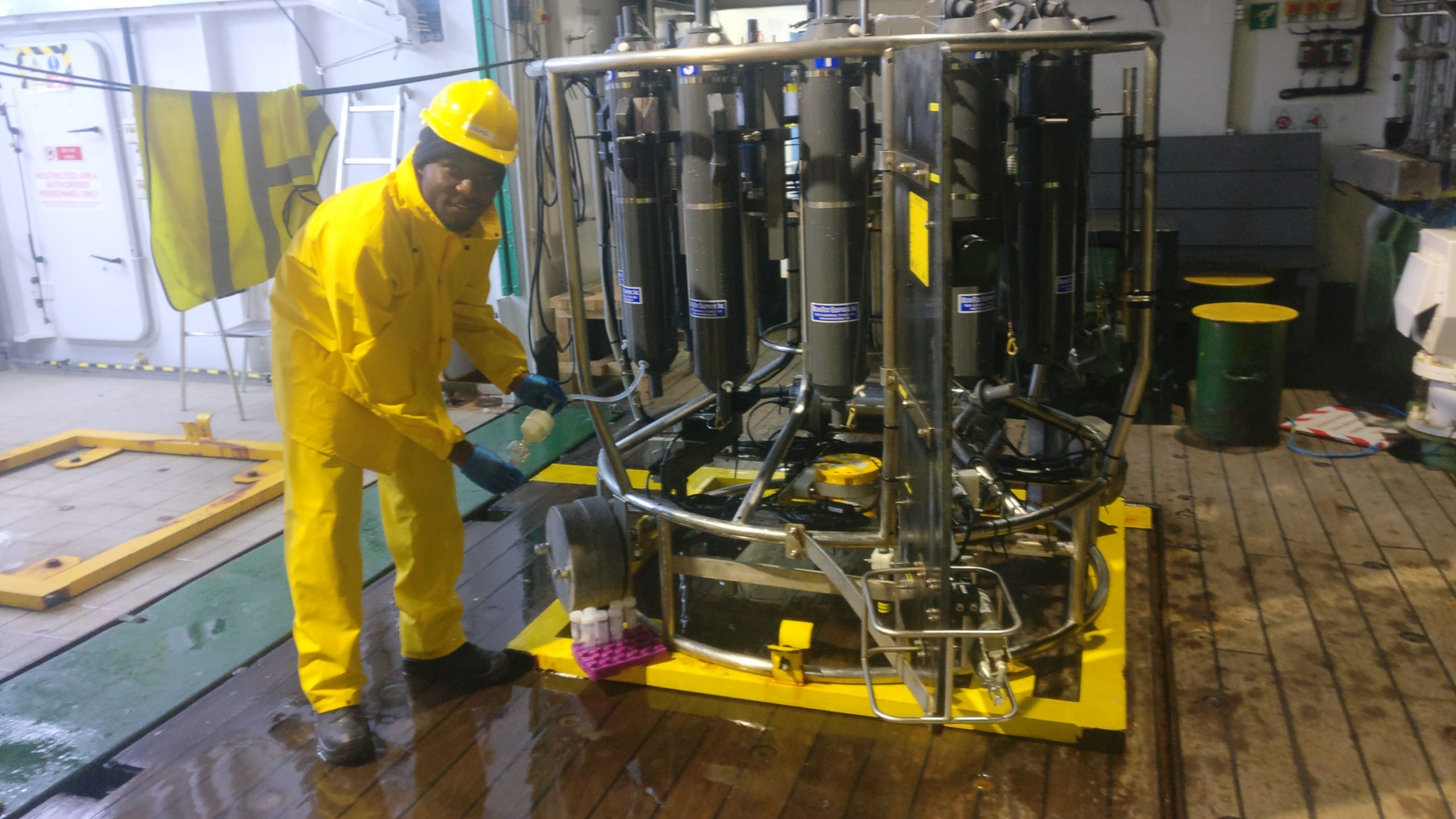
Testing Instruments in the Deck Pool
Paul Wittig is holding a Glider in the pool installed on the deck to calibrate its buoyancy.
August 14, 2022
Today was entertaining as Paul, Félix, and Christian calibrated the buoyancy of two Gliders. Gliders are autonomous underwater vehicles using buoyancy to move around. As they can change their pitch, i.e., angle, they can glide horizontally while moving up and down the water column. Calibration of the Glider’s buoyancy consists of setting the Glider density close to that of the water mass it is deployed. To do so, a small pool has been assembled on the deck and filled with seawater. Then Paul and Félix put on an aquaphobic combination to not get cold as they had to stand still in the water which temperature is around 10oC. After successful tests, the Gliders are now ready for deployment in the ocean, but that will be for another day.
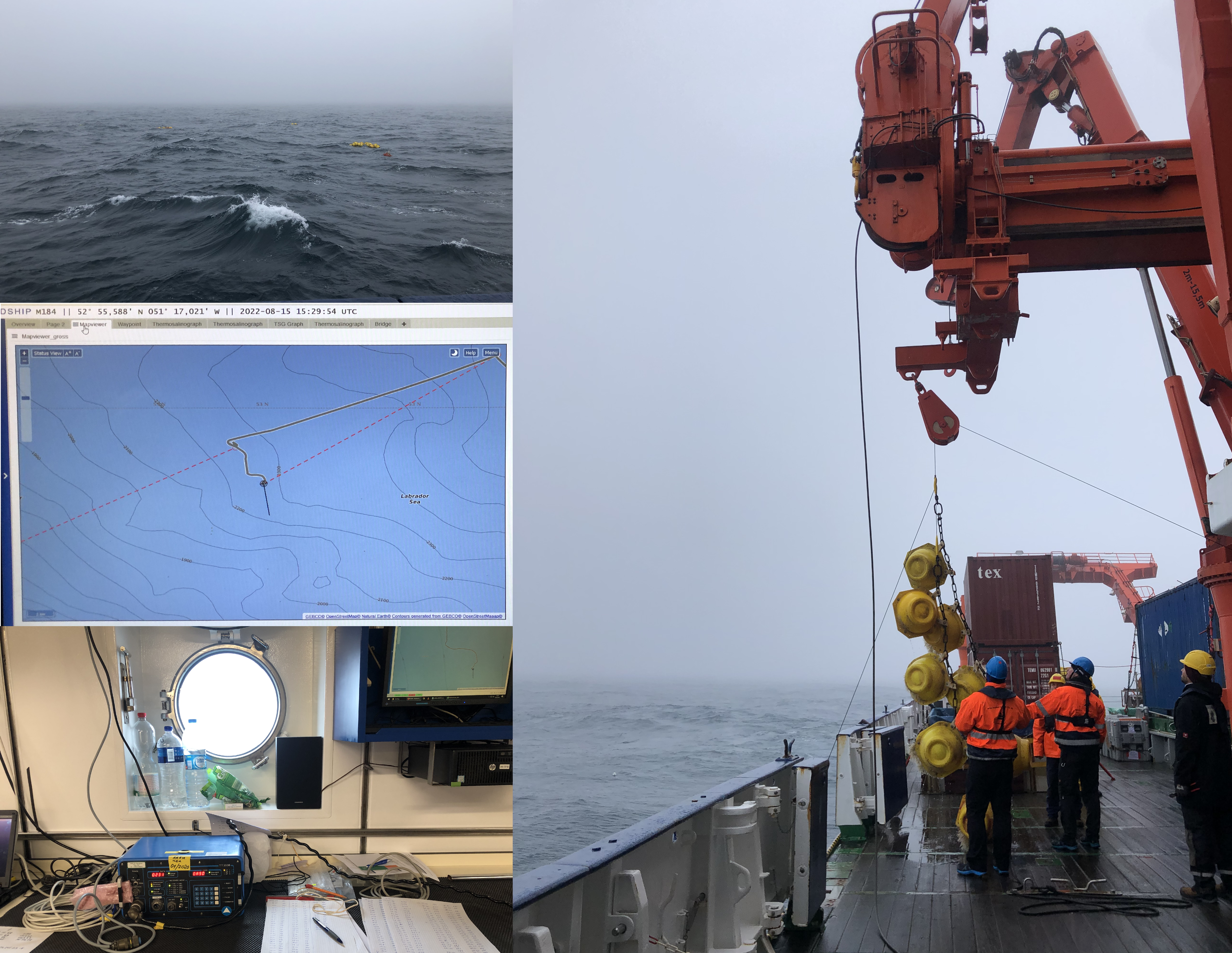
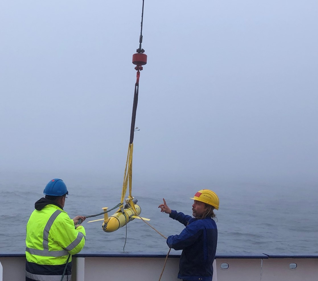
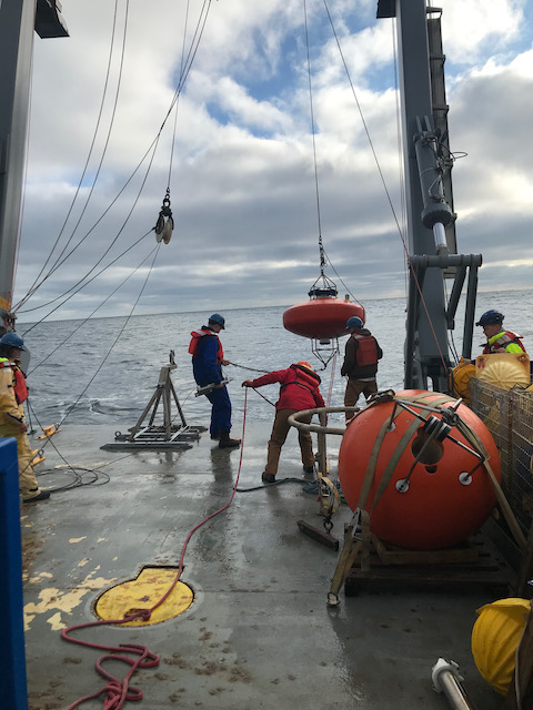
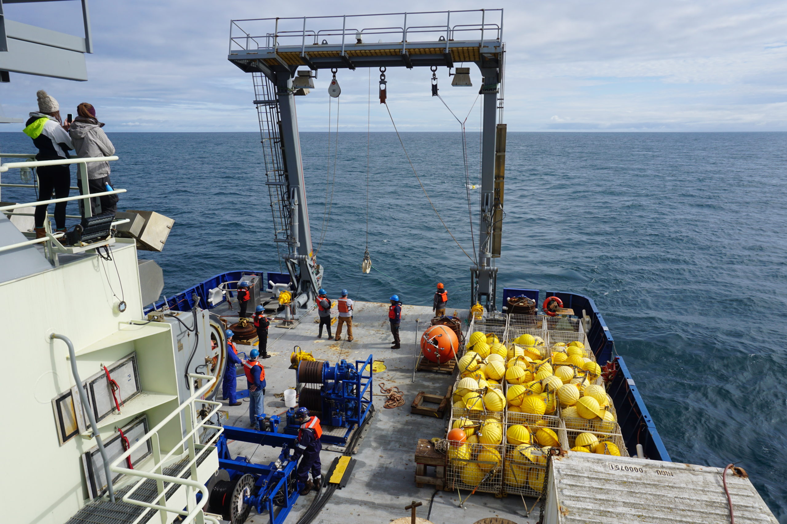
Station K8 – Recovery of a Mooring Array in the Fog
(1) The mooring array is floating at the surface of the sea after we remotely detached it from its anchor. (2) Meteor changed its direction many times as we were looking for the mooring array. (3) We obtained the distance between us and the mooring array from an acoustic deck unit. (4) The crew recovering the mooring array with a winch.
August 15, 2022
To measure the ocean circulation, mooring arrays have been deployed since 2014 in the Labrador Sea as part of the OSNAP program (o-snap.org) and are serviced every two years by scientific expeditions like ours. Today we successfully recovered the K8 moorings and the measurements that it took over the past two years. But it was not so easy!
The weather was quite nice in the morning. As we were approaching station K8, we sent an acoustic signal to the K8 mooring array so that it detaches itself from its anchor and starts floating at the surface. However, a few moments later, we entered a thick fog, which complicated the recovery. Despite the fog, we could guide ourselves to the array using the acoustic deck unit, which shows at which distance we are from the array. After a few hours of hunting in the fog, we finally got visual contact with the array. The crew then recovered the mooring array with their winch, and we could start cleaning it, extracting the datasets, and the preparation to put it back to sea for another two years.
Glider Deployment
Christian Begler and a crew member are deploying a Glider.
August 16, 2022
After the successful calibrations performed yesterday, one of the two Gliders has been deployed today. It will be autonomous and take measurements of water properties, such as temperature, salinity, oxygen, and chlorophyll until its recovery a few days from now.
Deployment of the Glider. Video by Johannes Karstensen.
Our cruise is now about halfway through, and spirits are high as we steadily make progress on accomplishing our cruise objectives. Yesterday the final University of Miami mooring was deployed in the Iceland Basin, completing the turn-around operations on all of the seven moorings deployed along the eastern flank of the Reykjanes Ridge. We have now turned the mooring operations over to the NIOZ team, who at this moment are deploying their westernmost Irminger Sea mooring (see photo), and if all goes well will follow that with the deployment of their second (of five) moorings this afternoon.
It is a rather nice morning in the Irminger Sea, with relatively calm conditions and the sun even peeking through the clouds from time to time. Apart from a following swell that is occasionally putting some water on the aft deck, it is a fine day for mooring work, seriously challenging our usual mantra that “it is nicer in the Iceland Basin”. Our mooring operations there were mostly in overcast and often cold, drizzly conditions and so the weather today in the Irminger Sea is a pleasant surprise (however, not to be discussed further..). The only major glitch we have encountered so far is that one of the U. Miami moorings unexpectedly returned to the surface after its deployment, while communicating with the acoustic mooring releases to put them into “sleep mode” for the next two years until we come back again, and that mooring had to be recovered and redeployed again, basically costing us a day of ship time. This is one of the reasons, besides unpredictable weather, that we build a little extra time into our cruises for contingencies.
The U.S. and Dutch teams continue to work very well together, and this is particularly evident on deck during the mooring operations. During the first half of the cruise, when the U. Miami mooring work was taking place, the two lead technicians from NIOZ (Leon Wuis and Toon Koopman) ran the mooring winch for the U. Miami team, who were busy loading instruments and floats onto the mooring line as it was paid out. Now the lead U. Miami technicians (Eduardo Jardim and Cedric Guigand) are doing the same for the Dutch team as they recover and deploy their moorings. It is always interesting to see how different research groups approach their mooring operations, with somewhat different mooring designs and different methods of deployment. For example, the NIOZ team uses a “mooring table” (pictured in the photos) that has a built-in stopper system for changing mooring wires and attaching instruments, whereas for the U. Miami moorings this is all done at deck level using a traditional double line stopper system.
The mooring winch system we are using is a specially designed system called a LEBUS (aka “double barrel”) winch system (see photo) that is somewhat complicated but highly efficient for performing rapid mooring turnaround operations. It takes two people to run it with a third assisting, and with at four people on the aft deck making mooring connections, and several others bringing instruments in and out from the lab, it requires a large team and a carefully choreographed operation.
With the change-over in mooring operations, the night-time CTD watches have also changed at mid-cruise to free up personnel from the Dutch team for their mooring work. During the first half of the cruise, these watches were mostly manned by NIOZ scientists but now they are being mostly manned by the U. Miami team. Everyone is adapting to these changes well and pitching in wherever needed. It has been a great pleasure sailing with this entire team thus far, and – as we often say – “so far so good”, with our fingers crossed.
“Well, I’m somewhat of a stowaway here…” This is how I’ve been introducing myself to some crew members in the messroom during dinner or when fetching some late-night cereal. I had never been to the open sea before this cruise. I usually study the ocean from my desk, using models. Some are idealized, capturing just the essence of a particular process, while others aim to represent the ocean as well as possible. Still, we will never be able to simulate the entire ocean, with all its diverse structures, in the finest details. This is why sea-going oceanographers embark on research cruises – to try to observe how the ocean truly behaves.
Although ocean observations are not directly part of my Ph.D. research at Utrecht University, I consider myself a physical oceanographer-in-training. Of course, part of that training is to get out there and see the thing I’ve been studying from my desk for the past years. With some asking around, I was lucky to get a spot in Femke de Jong’s science party from the Royal Netherlands Institute for Sea Research (NIOZ) on this cruise aboard the R/V Neil Armstrong. Our goal is to recover and deploy moorings that are part of OSNAP (Overturning in the Subpolar North Atlantic Program), together with scientists from the University of Miami. Last week, we steamed off from Reykjavik, and we will return there again in two weeks.
Daan and Emma sampling salts from the Niskin bottles
Daan and Emma sitting at the CTD station
While we’re working on the mooring array, we’re ‘doing CTDs’ along the way, measuring conductivity, temperature and depth at specific locations. This helps us understand the water’s profile and properties at the locations between the moorings. CTDs are the “bread and butter of observational oceanography”, as Bill Johns, chief scientist of this cruise, phrased it during the science briefing. So, what better way to immerse myself in observational oceanography than to immerse the CTD into the water every day? By the way, CTD refers to the measurements, the activity of taking those measurements and the instrument set we use for it. As a ‘CTD watch’, I take care of the measurements by dropping a set of instruments into the water, or rather, communicating with the bridge and the winch operator to carefully lower the CTD to specific depths. The CTD’s casing is lined with a ‘rosette’ of so-called Niskin bottles, that can be closed at specific depths to sample water, which is used for calibration of the instruments. Every time the CTD gets back on deck after we sent it off to 20 meters from the ocean floor (making sure not to hit it!), we take the samples from the Niskin bottles. We literally get in touch with the water’s profile as the sampled water that streams over our hands get colder with the depth at which the bottles were closed. If I’d ask for more immersion, I’d have to jump off the ship and swim away with the pilot whales.
I’ve now grown accustomed to my bread and butter and hopefully, it’s smooth steam from here on out. With approximately one week done and two ahead, I’m looking forward to helping out with the recovery of the NIOZ moorings, but also to continued fun with everyone on board. The major takeaway from my participation on this cruise is an obvious one: it takes a tremendous amount of effort in terms of time, planning, resources and most of all people power to deploy a mooring or to go out on a CTD transit, from the scientists and engineers to the mates, oilers or cooks that form the ship’s crew. It’s something I knew, but also something I will forever appreciate, whether I’ll be looking at observations or models. What is the latter without the former anyway? In any case, after this experience (and earning my sea legs) I’ll never again have to introduce myself as a mere stowaway modeler.
It’s 11 pm – time to wake up! I re-open my porthole and it’s now dark outside, with only the whitewash as a contrast against the dark sea background. I stumble around my cabin – getting dressed, brushing my teeth and hair – struggling to tell if I keep bumping into things because of my lack of balance in the morning or the ship’s swell!
I pop into the main lab on my way up to breakfast to check everything is going ok for the previous shift (and to work out how many CTDs we’ll be doing tonight)! It’s then time for a quick breakfast before my shift starts. My typical breakfast of porridge is almost as accurate as the radar measurement of significant wave height – with the milk sloshing back and forth as I put my porridge in the microwave. Then it’s back to the main lab to start the shift (and convince those on the previous shift that it’s time for them to go to sleep)!
As mooring recovery and deployment need to be done during the day, we as the night shift typically do back-to-back CTDs. Over the first few days of night shifts, when we were over the relatively shallow shelf, this reached up to 4 CTDs in one night! But it calmed down considerably over the next week to 1 or 2 CTDs a night, when we entered deeper water and each CTD deployment took considerably longer (~2-3 hours)! This was particularly true of the “caldip” moorings, used to calibrate sensors pre and post-mooring recovery/deployment, which have 5-minute stops at various depths.
It’s then time to prepare the CTD logsheet ready for the first CTD. If the CTD’s recovery is imminent or we’re lucky (and those on the last shift were bored) this will already be ready for the first CTD of the shift. It details the Niskin bottles fired and what depth they were fired at, as well as what Niskin bottles/depths we need to take water samples from such that we can analyse them for dissolved oxygen, and dissolved inorganic carbon (DIC), nutrients and measure their salinity. This logsheet also details the Niskins / depths from which duplicate or triplicate samples will be taken. We also write out a separate logsheet just for the dissolved oxygen samples that contains the bottle numbers of each sample (along with the associated Niskin bottle it will come from and the depth of that bottle) and another logsheet if we are also taking DIC samples.
Once the CTD is almost up, we pop on our waterproofs, steel toecap boots and hard hats and bring out everything we need to collect our samples. This includes 2 clipboards with all the logsheets, lots of numbered bottles with stoppers (for dissolved oxygen, DIC and nutrients), plastic tubes for collecting dissolved oxygen and dissolved inorganic carbon samples, a thermometer and spare beaker for measuring Niskin bottle water temperature, and Stanley (the carry crate that holds the pipettes with and in them, used for the dissolved oxygen samples).
We watch the CTD being recovered – on day 1, we all watch with avid interest and by day 10, it’s all just part of the routine. Once, we’re informed the CTD is securely back on board, it’s time to begin sampling! We start with dissolved oxygen – to limit the gas exchange of water in Niskin bottles and the surface air – making sure to close each bottle securely after sampling. First, we take each Niskin bottle’s temperature before rinsing the first sample bottle and filling it – hopefully without any bubbles!!! We then work our way around the CTD, starting with the first Niskin fired (at the greatest depth) and finishing with the shallowest Niskin.
If taking DIC samples, we then have someone (in our case me) follow that first person, making their way around the CTD rosette, collecting each sample. By the last day, we’d perfected the art of knowing when the DIC sampler should start, such that a Niskin bottle would never be open for 10 minutes but such that the DIC sampler never caught up with the dissolved oxygen sampler! The DIC samples then go back to the chemistry lab to be poisoned (and stop any phytoplankton still living in the sample from removing all the DIC!).
Next up is nutrients. Niskin bottle water goes through a filter to remove any large particles before entering the plastic nutrient tubes. These samples are then frozen, ready to be transported back to SAMS to be analysed.
Finally is salinity – we obtain a sample from each bottle in order to be able to calibrate the conductivity reading from the CTD rosette. Each sample is collected and then the neck of the bottle must be dried (inside and out) to make sure no salt crystals can form on the top of the bottle and fall into the sample – artificially raising the conductivity (and salinity) measurement. The sample is then stoppered and capped, before going back into the crate of samples. Once a crate is full, it gets rinsed and carried to the salinometer room, where samples will later be analysed by the autosal salinometer. As conductivity measurements are very temperature dependent, the entire room is kept at a constant temperature (of 21C), such that all the salinity samples can equilibrate to this temperature before analysis.
Once we’ve successfully managed to collect all the water samples we need, we return to the main lab. We then need to scan all the logsheets to make sure we have a copy just in case anything happens to them. We also run a series of scripts to process CTD data, removing all the times when sensors were recording before and after the CTD was in the water and removing any spurious data spikes (particularly in salinity).
This cycle repeats until the waft of freshly cooked pastries informs me it’s almost breakfast time! I’m then faced with 20-30 minutes of temptation to run and grab a croissant/pain au chocolat whilst they are still fresh! It’s then time for breakfast and time to say good morning (/ good night / good day?) and to hand over to those on the day shift.
A simple Python code that computes the meridional overturning circulation (MOC) from a model dataset interpolated onto the OSNAP section. More information can be found on the o-snap website under the tabs Outreach/For Modelers and the code can be downloaded here.
After four years the University of Miami and Royal Netherlands Institute for Sea Research (NIOZ) teams are once again out at sea together again. Four years ago we were here on the RV Neil Armstrong, together with the UK OSNAP (Overturning in the Subpolar North Atlantic) folks, to recover and deploy OSNAP moorings. Two years ago, we had planned to sail together on the Dutch RV Pelagia, but unfortunately due to COVID no international travel was possible in 2020 and the NL and US teams had to sail separately from their home ports on RV Pelagia and RV Armstrong. Fortunately, this year we are able to travel again and we can once again join forces on the Armstrong and sail from Reykjavik, Iceland.
Unfortunately, COVID is not gone and it’s still a hazard to those going to sea far away from hospitals and advanced medical care. We’re in close proximity to each other on board, with many of us sharing cabins. Each of us was required to get an official COVID test prior to boarding the cruise and testing was repeated once we came on board in Reykjavik. Sadly, even though we were all very careful and wore masks while travelling, one person did test positive in Reykjavik. After some back and forth between the ship and the ship’s office on shore, it was decided that the risk of taking that person on board was too great. So we had to leave port one person down. The rest of us have been testing daily to make sure no further problems show up unexpectedly.
The Armstrong left port on the morning of Friday 22 July. After some underway safety drills our first official activity was a test/training CTD in deep waters south of Iceland. The CTD is lowered over the side of the ship on a cable and measures Conductivity, Temperature and Depth from the ocean’s surface down to the bottom. We will do many CTD stations, both to calibrate the moored instruments and to get some data on the hydrography in the gaps between the moorings, so there are people in the CTD watches 24/7. For some of them, it’s the first time, so a training station is always good to do.
After another CTD station on Saturday, we arrive near the first CTD stations on the line on Sunday morning. Off our starboard bow was the RRS James Cook, carrying the UK OSNAP team. They had nearly finished their cruise and were down to deploy their last mooring on the line. By coincidence, as the dates of both cruises have shifted repeatedly over the last months, the Armstrong was there at the same time starting our line. Since such occasions are rare, we must make the most of them. The James Cook did a short flyby, sailby?, the Armstrong, we waved and wished them a good voyage home. By then it was time to get our own program started, with CTD stations towards the first mooring location.
On Sunday we got to the first mooring, which is the easternmost US mooring in the Iceland Basin. This is a relatively short (1000m) mooring that measures the deep flow. After some initial difficulties talking to the releases, which is done acoustically via the ship’s transducer, the mooring was successfully released and brought on board. In the afternoon, the mooring was deployed again with new instruments and batteries. This is the schedule we’ll follow for the next few weeks. CTDs overnight, mooring recovery in the morning, mooring deployment in the afternoon, a survey to determine the final mooring position and then back to CTDs. CTDs and Miami moorings will gradually become shallower as we move up the Mid Atlantic Ridge, and then deeper as we move down the Ridge to do the NIOZ moorings. All of this interspersed with excellent breakfasts, lunches, cheese 30s and dinners. Hopefully all will go smoothly…
Tirelessly, full of determination, and with a hint of stubbornness, the ship cleaved its way through the sea. It hadn’t seen land for days and now, in the middle of nowhere, it was hard to believe that anything but ocean existed. As the ship diligently fulfilled its duties, station by station, day and night, it had almost forgotten where it came from and where it was heading. And why shouldn’t it? In the vastness of space, it was easy to lose perspective.
Its overarching mission, however big and important it may have been, faded away, like land disappearing behind the fog. The world’s problems and crises, uncertainties, and all the questions without answers, became tiny compared to the everyday struggles with the elements, making it easy to create a new meaning, safe, and far away from a world that was about to capsize and in which fossil fuel consuming ships had no future.
Thus, the ship moved on, faithfully, from station to station, clinging to a reality on the narrow line between the water and the sky. If the world went down in this very moment, the ship would not notice. For a split second, it would startle. Like a sleeping cat surprised by a sudden noise would it wake up, before drifting into another dream on another sea, in another world, as a new time had begun.
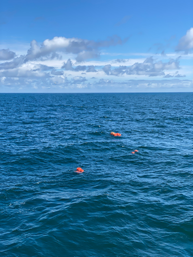
On 15 July, we recovered the first mooring system at the easternmost point of the OSNAP array. A mooring is an anchored system that consists of many instruments at different depths attached to a long wire. It stays in the ocean for many months and helps us to continuously measure ocean properties like temperature, salinity and the velocity of ocean currents. The mooring is held in a vertical position by several buoys of different sizes located at certain water depths along the wire. During our expedition, we are recovering and deploying eight moorings. The first one that I’ll write about today spent around two years in the ocean.
During the recovery process, the ship first comes close to the location where the mooring was deployed in 2020. The technicians from the National Marine Facility (NMF) in Southampton talk to it from the ship using an acoustic transducer. Once they receive a response from the mooring, the acoustic release is activated and disconnects the mooring from the anchor – and the whole mooring rises to the surface waiting to be taken on board. The wire can get quite tangled on its way to the surface – so the instruments and floats do not necessarily come onboard in the exact same order they have been initially deployed.
The mooring afloat on the ocean surface after being released from the anchor.
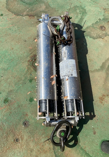
Current meter that has just been recovered from the mooring system that spent two years in the ocean collecting the data.
Once the mooring is visible on the water surface, the ship comes closer and all sensors and buoys are brought to the deck. After spending two years in the water, the instruments and buoys are covered in seaweed and clams which are being heroically cleaned out by the mooring team on the deck. After this, all instruments are being brought into the lab, where the mooring team downloads all the data.
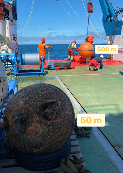
Buoys and instruments that are closer to the surface are more prone to overgrowing – for example, the buoy that was on 50 meters is all covered in seaweed and some small shells and clams, while the one that has been on 500 meters is almost clean. This happens because no light penetrates to this depth, and there is way less life there.
Two buoys that have been keeping the mooring system afloat – the one that was on 50 m is all overgrown, while the one deployed in 500 m is almost clean.
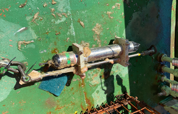
Picture 5. Acoustic release.
Following the recovery of the last set of floats, the acoustic release system is also taken out of the water to be redeployed again on a next mooring. To release the mooring wire, instruments and buoys from the anchor, the releaser opens a gate that connects the mooring wire to the anchor. The release mechanism is activated by a specific acoustic signal sent from the ship by the NMF technicians. Once detached from the anchor, the buoyant floats along the mooring allows is to rise to the surface. The acoustic release system consists of two individual releasers to add a measure of redundancy. Each of the releasers is able to open the gate – so even if one of them wouldn’t work, there is a second one that acts as a safety net.
This last video shows how the last chain of floats and the acoustic release are being taken out of the water and the ship sets sail. In one of the next posts, I’ll tell about how to deploy a mooring – this process turned out to be quite nuanced as well. Stay tuned! 🙂
The UK OSNAP team left Southampton on 12 July and is heading into the sub-polar North Atlantic. We will be working on the very eastern part of the OSNAP line from the Hebrides shelf via the Rockall basin to the Iceland Basin. This is the region where two major branches of warm and salty Atlantic waters flow into the Arctic, and we have various different oceanographic equipment on board to measure these ocean currents.
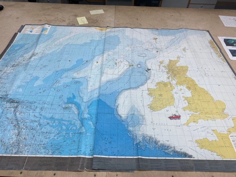
Picture 1: Map in the main lab showing the expedition region with the current location of the ship, mooring stations, and Argo deployments sites (ship’s position is updated daily). Photo from Rita Markina.
We will recover and redeploy several moorings that have been recording ocean properties continuously since Oct 2020. We will do a bunch of CTD stations where we will measure vertical profiles of ocean temperature, salinity, oxygen, fluorescence, pH and current velocity, and sample water at different depths for sensor calibration and chemical analysis of carbon, oxygen and nutrients. Apart from this, we will deploy three biogeochemical Argo floats which will measure CTD profiles and at least three (pH, nitrate, chlorophyll) out of the six biogeochemical Argo parameters (oxygen, chlorophyll, BBP, nitrate, pH and irradiance). These parameters are important to assess ecosystem health. There is also a brand-new bottom pressure recorder on board that we will deploy. A second recorder will be installed at the western basin during M148 led by our German colleagues from GEOMAR in August. The bottom pressure data on either side of the Atlantic will allow us to estimate the amount of water transported between the two instruments. More on this measurement system and how it works here: https://www.sonardyne.com/ocean-bottom-pressure-data-unlocks-amoc/
While our ship is moving north, the crew, technicians and science team prepare all the equipment, and those of us who are here for the first time are familiarising ourselves with the ship – which looks gorgeous. Check it out with this virtual tour: https://noc.ac.uk/facilities/ships/rrs-james-cook/rrs-james-cook-virtual-tour.
This morning we saw the dolphins! They came really close to the ship – curious about what we are up to (or just enjoying the waves).
Picture 2. Dolphins following RSS James Cook in the Irish Sea. Video from Rita Markina.
More details about our work and life on board are soon to come!